ZONE 4 – ROUTE 7

The Path
MOUNT LEGNONCINO
MTB trail accessible with good physical preparation, departure and arrival from the Dervio sports center, with the possibility of ample parking for cars and campers, a stone’s throw from the lake with a bar and relaxation area.
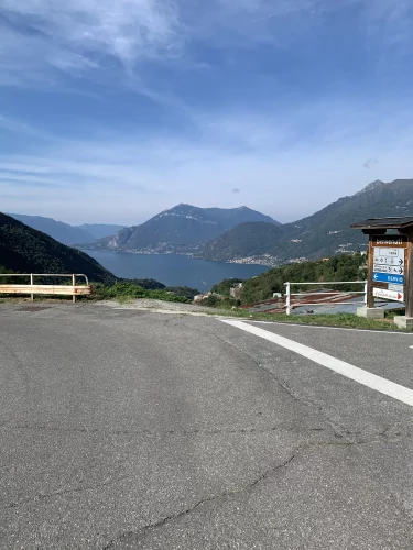
The first part of the route is mostly on asphalt, to make the climb to the summit less complicated, having at your disposal among other things several fountains along the way. You then proceed in the direction of Sueglio, seeing the lake from various angles from the road. After crossing the town of Sueglio, you reach the hamlets above, Loco Tocco and Loco Peniano, small villages that mostly host holiday homes. Note a particular B&B with a terrace in the tree.
Continuing along the track, you enter the first area finally flat, where there is spring water. In the background we notice part of the lake between the trees.
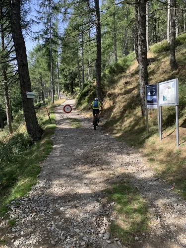
At the end of the dirt road there is an e-bike charging station, from there you get back on the asphalt for the most challenging stretch of about 3 km, arriving at the entrance to the dirt road that leads to the top of Monte Legnoncino. Nearby is the Rifugio Roccoli Lorla.


Almost at the top you can freely visit the old trenches, used as lookouts during the First World War.
You can continue on foot for a short distance to reach the summit and admire the lake in all its grandeur.
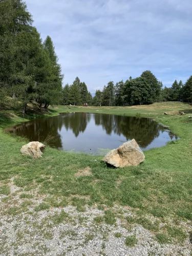
Then you return along the same road to the Rifugio Roccoli Lorla, where there is a characteristic lake with an adjacent fountain for watering grazing animals.
There is another charging station for e-bikes.
We continue downhill towards Rifugio Bellano, which is open only for short periods of the year, mainly in summer. During this downhill stretch, we pass other trenches with suggestive tunnels, also dating back to the First World War. Also noteworthy are some points of the descent that are particularly exposed to the valley, where you need to pay more attention.
Once the first part of the descent is over, just below the Bellano Refuge, you pass by the Roccoli d’Artesso, which also features a small lake with a fountain and the possibility of a picnic with a barbecue.
We continue towards Sommafiume, another town inhabited by holidaymakers in the summer.
Heading towards the locality of Vezzée, you descend along a fairly wide and fun agro-forestry pastoral road; it is advisable to pay attention only to a passage near the river, where it is advisable to accompany the bike by hand.
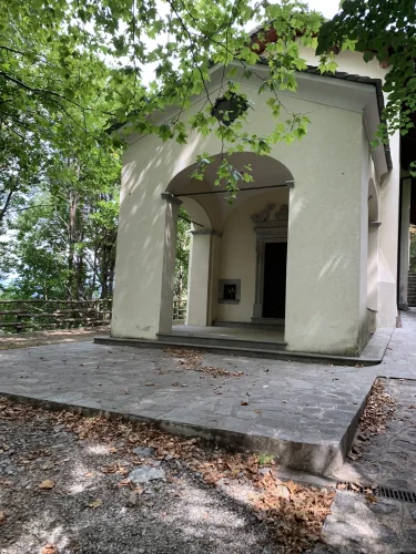
Another suggestive passage is from the Sanctuary of the Madonna di Bondo, along the last descent, also passing by the water collection basin for the power plant located on the lake shore.
Finally, we proceed on asphalt; if you want and without any particular problems, you can make easily identifiable cuts to reach Dervio.

Technical Data
MOUNT LEGNONCINO

Path status:
Good / Optimal
Difficulty:
MEDIUM: Suitable for an
average user. It presents small
technical difficulties and requires
basic training.
EXPERT: Suitable for bikers with
experience and training on
mountain routes
Recommended bike:
ebike/mtb
Degree of historical/landscape interest:
9 su 10
Route lenght:
39,5Km
1530 mt
1530 mt

Activities and services
MOUNT LEGNONCINO
Existing Signture:
POOR: There are signs with pedestrian directions.
Charging point:
There are two charging points
Workshops and shops:
There is an e-bike assistance and rental shop in Dervio.
Intermodal connections:
Circular route starting and finishing in Dervio. Dervio can be reached by bus, train and boat
Along the Route:
There are numerous refuges and farmhouses.
Gallery
MOUNT LEGNONCINO
Reports
MOUNT LEGNONCINO
Report a Point Of Interest along the Route
With this feature LarioGT wants to be a point of reference for the biker community of Lake Como. If you think that along the route it is useful to report a Point of Interest (a fountain, a viewpoint, a commercial activity useful to us bikers, but also a dangerous point) use the following Form to send us the details, if you know the coordinates in decimal degrees (latitude and longitude) or more simply the exact address and you have photos or documents useful for your report, attach them and write a comment about your report, we will moderate the report and insert it into the map!


