ZONE 3 – ROUTE 5
The Path
LARIANA RIDGE FROM BRUNATE TO BELLAGIO
The itinerary on the Larian ridge is proposed as the main track of the Como Grand Tour with the crossing of the Larian Triangle with a 360° panoramic view on both shores of the lake.
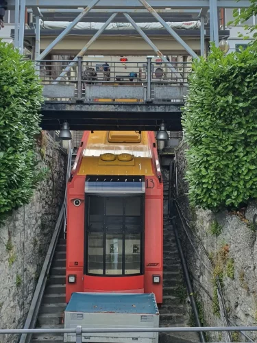
The tour starts from Como where we can choose whether to go up to Brunate by bike via the asphalt road or to save altitude with the help of the funicular. From Brunate, after a transfer section passing by the Voltiano Lighthouse we reach the Cao Parking and it is from here that the Larian ridge begins.
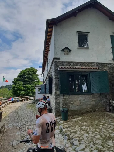
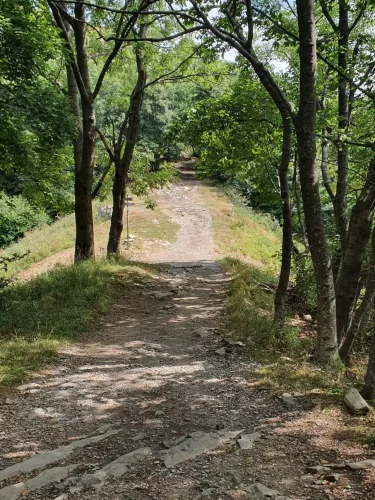
The dirt road is wide and pleasant and alternates stretches of beaten earth with stretches of ancient mule track: on our left we will find some huts with refreshments that take their name from the respective mountains.
Once you reach the Bolletto hut, the path narrows and before getting back on the mule track, you will have to tackle the most technical and evocative part of the route, crossing the Sentiero dei Faggi: a fairly narrow single track section immersed in an enchanted beech forest.


Back on the mule track we will find the Riella refuge on our right and continue towards the Sormano col. There will be plenty of panoramic points and refreshment options along the entire route.
Once we reach the top we have 3 options available:
- go down to the left towards Nesso passing through Pian del Tivano;
- continue straight towards S.Primo/Terrabiotta and tackle the very technical descent towards Pian Rancio and Civenna (route with EXTREME difficulty level);
- go down to the right towards Caglio Rezzago.
On our itinerary we choose to descend to the right taking a slightly rough but passable dirt path that takes us to the town of Caglio and then to Rezzago.
At this point we head on asphalt towards the Madonna del Ghisallo, where it is possible to visit the cycling museum and enjoy a priceless view and then continue towards Bellagio, the pearl of Lake Como.
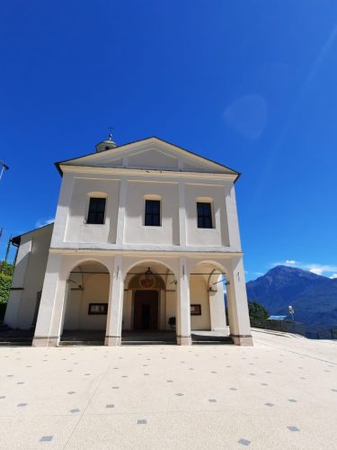
After a well-deserved break, the long descent towards Dongo begins, following the same path as the climb to the Mottafoiada crossroads. From here we continue towards Bocchetta to tackle a fun descent on mule tracks and paths. Alternatively, you can continue on the asphalt road, very wide and easy, which always leads to Dongo through the towns of Garzeno, Germasino and Stazzona. We return to our descent through paths and mule tracks and arrive at the beautiful village of Stazzona, where you can enjoy a wonderful view of the upper Lario. Here we take the narrow passage to the right of the beautiful church dedicated to San Giuliano and head towards Dongo.
We pass in front of the famous Crotti di Stazzona, a very popular summer destination for its local dishes and for the special location that has maintained an ancient imprint over time, typical of the rural area of Lario.
Once past the crotti of Stazzona, we have now reached the starting point of this beautiful circular tour.
We started from the shores of the lake, to reach the high mountain landscapes, through beech and pine forests and then dive back into the lake on fun mule tracks, typical of these areas.

Technical Data
LARIANA RIDGE FROM BRUNATE TO BELLAGIO

Path status:
Good
Difficulty:
MEDIUM: Suitable for an
average user. It presents small
technical difficulties and requires
basic training.
Recommended bike:
ebike/mtb /gravel (for experts)
Degree of historical/landscape interest:
9 su 10
Route lenght:
38,1 Km
1110 mt
1520 mt

Activities and services
LARIANA RIDGE FROM BRUNATE TO BELLAGIO
Existing Signage:
POOR: There are signs with pedestrian directions.
Charging point:
Absent.
Workshops and shops:
There are specialized shops in Como and Bellagio.
Intermodal connections:
The itinerary is from A to B starting from Como and going up to Brunate by cable car and arriving in Bellagio. The return to Como is possible by boat or bus.
Along the Route:
There are numerous refuges and farmhouses.
Gallery
LARIANA RIDGE FROM BRUNATE TO BELLAGIO
Reports
LARIANA RIDGE FROM BRUNATE TO BELLAGIO
Report a Point Of Interest along the Route
With this feature LarioGT wants to be a point of reference for the biker community of Lake Como. If you think that along the route it is useful to report a Point of Interest (a fountain, a viewpoint, a commercial activity useful to us bikers, but also a dangerous point) use the following Form to send us the details, if you know the coordinates in decimal degrees (latitude and longitude) or more simply the exact address and you have photos or documents useful for your report, attach them and write a comment about your report, we will moderate the report and insert it into the map!


